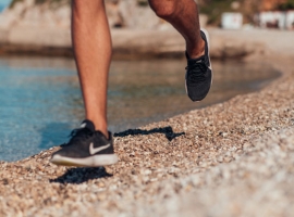
CYCLING
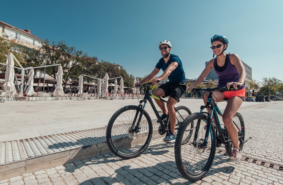
Because of its outstanding geographical location combined with a mild and pleasant climate, the Crikvenica Riviera is ideal for both professional and recreational cycling enthusiasts. Thanks to the area’s favourable weather conditions, you can have a great time on two wheels at almost any time of the year. This type of terrain offers excellent conditions for MTB enthusiasts at an altitude of 1,200 metres, and those who just want to take in the scenery can cycle across the lowland part of the Vinodol Valley and the island of Krk. A short ride or a more demanding tour of up to 150 km – a great cycling adventure is guaranteed.
If you don’t feel ,like cycling alone, then visit the Crikvenica cycling club, which will gladly help you prepare for the tour. If you, however, decide to ride alone, then we recommend the six marked trails in this area: the Blue, Green and Brown trails, the Carmine Trail – the Lily Trail, the Violet Trail, and the Yellow Trail – the View Trail.
The cycling paths described here will lead you from the coast and nearby Vinodol all the way to the green hinterland, and will give you the opportunity to admire a variety of attractive landscapes. The area of Crikvenica and Vinodol offers approximately 300 km of diverse cycling tracks. Some of them are suitable for recreational cyclists, while others are more demanding and represent a challenge, but also a unique experience, for professional athletes and competitors in cycling races.
On the Crikvenica Riviera, you’ll find many accommodation properties that welcome cyclists: the Hotel Omorika in Crikvenica, Hotel Katarina in Selce, and the Selce campsite all have a Bike Friendly label. There are also private accommodation providers who offer services in compliance with the Bike & Hike Kvarner Family standard.
Cycling maps of the Crikvenica Riviera, Novi Vinodolski and Vinodol areas are available in local Tourist Information Centres (TIC).
Info:
Crikvenica cycling club
Kotorska 15, Crikvenica
biciklisticki.klub.crikvenica@gmail.com
www.bkc.hr
Licensed cycling guides:
Alen Tomašev
+385 95 202 2019
alen.tomasev@yahoo.com
Marko Jerković
+385 95 368 5715
jerko_1990@hotmail.com
Aleksandra Domijan
+385 91 240 5678
elbike.crikvenica@gmail.com
www.elbike-crikvenica.com
The maps include detailed descriptions of six different cycling tracks:
- the Blue Trail
- the Green Trail
- the Brown Trail
- the Carmine Trail – the Lily Trail
- the Violet Trail
- the Yellow Trail – the View Trail
The Blue Trail
The Blue Trail starts in Novi Vinodolski and continues along an asphalt road up a gentle hill through Vinodol Valley to Bribir (5 km). From Grižane, it descends to Tribalj (15 km), where it turns right and goes to Drivenik (18 km). From Drivenik, it goes back to Tribalj and turns right towards Crikvenica (28 km). In Crikvenica, it turns left to Selce (31 km) or right to Dramalj-Kačjak and Jadranovo. After leaving Selce along the main coastal road, it turns left to Bribir. At Barbara Pass (33 km), it turns right and descends through the plains of Bribirsko Polje and Novljansko Polje to Novi Vinodolski (38 km).
The Green Trail
The Green Trail starts in Novi Vinodolski, and continues along an asphalt road with an ascent of 6 % to Bater (10 km) and Pleteno (13 km), where it turns left towards Ravno and after 3 km of asphalt road it follows a gravel road through a forest to Ravno (21 km). The asphalt road continues to Stup (24 km, at an altitude of 912 m). After Stup, the route turns left onto a gravel road and goes down to Križišće (51 km), where it turns left and goes through the Vinodol Valley towards Drivenik (56 km), and next along the lake to Tribalj (59 km). After that, it turns left and goes up to Grižane (64 km), continues to Bribir (69 km) and Novi Vinodolski (74 km).
The Brown Trails
The Brown Trails starts in Novi Vinodolski, goes along an asphalt road which ascends to Breze (16 km) and Banska vrata (20 km, 925 m a.s.l.), where it turns left onto an asphalt forest road and continues through the forest to Ravno (38 km). At the tavern, it turns left, goes along an asphalt road for 0.7 km, turns left onto a gravel road, continues to Bušište (31 km), turns right to Bukovdol (37 km) and Žestilca (41 km), and then descends along an asphalt road to Bribir (45 km), where it turns left for Novi Vinodolski (50 km).
The Carmine Trail
The Carmine Trail starts in Novi Vinodolski, goes along an asphalt road which ascends to Bater (10 km) and Breze (16 km); half a kilometre after Breze, it turns right onto an asphalt forest road above the hamlet of Bulići (19 km, 900 m.a.s.l.), and then turns right onto a gravel road and goes to Krmpotska Luka (27 km). At the monument and crossroads, it turns right and descends down an asphalt road to Klenovica (36 km). There, it turns right and goes to Povile (41 km) and Novi Vinodolski (44 km). The trail is also the habitat of the protected Carniolan lily.
The Violet Trail
The Violet Trail starts in Novi Vinodolski and goes along an asphalt road which ascends to Bater. After 9 km, it turns right and continues along a gravel road for 8 km. At the crossroads, it turns right and follows the asphalt road for 2 km to the village of Bile (19 km). There, it continues for 7 km along a gravel road to a crossroads with an asphalt road in Zagreben (26 km). It turns left and goes up an 8% ascent to Podbilo (30 km). In Podbilo, it turns left at the church for Alan (34 km), and then after 1.5 km turns left. After a 0.5 km long asphalt road, it continues along a gravel road for 0.7 km, and then on asphalt to Podmelnik (38 km), where it turns right to Bater, continues for 2 km along an asphalt road, then turns right and goes along a gravel one for 4 more kilometres, and finally along asphalt to Novi Vinodolski (56 km).
The Yellow Trail
The Yellow Trail – the View Trail starts in Novi Vinodolski and goes along an asphalt road which ascends to Bater (10 km) and Breze (16 km); 0.5 km after Breze, it turns right onto an asphalt forest road above the hamlet of Bulići (19 km, 900 m.a.s.l.), where it turns right onto a gravel road and goes to Krmpotska Luka (27 km). At the monument and crossroads, it turns right and descends down an asphalt road to Podmelnik (31 km), turns right onto another asphalt road to Drsnik (34 km); turns onto a gravel road for Bater (39 km) and descends to Novi Vinodolski (48 km).